How To: Hike Locally and Rediscover Your Backyard
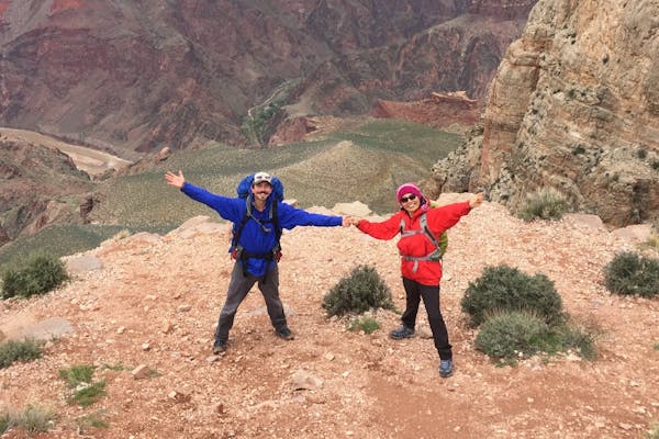
The roads are eerily empty. We speed along down highway 89 watching the setting sun cast long shadows across the ruddy mesas and monoliths that dominate the landscape. We’re fugitives on the run, breaking the "shelter-in-place" orders and heading towards our imaginary promised land, a printout of our backcountry permit as our ticket to freedom in these strange times. We’ve been driving all day, our packs are packed and ready to go as soon as we get to the trailhead which at this point is less than an hour away. All of a sudden, our phones start beeping and vibrating with email and text notifications as we drive within range of a cell tower, our first sliver of signal in almost an hour. I’m driving but M pulls out her phone.
“No… You’ve got be kidding…”
I pull over, and she puts the phone to my ear to listen to a voicemail.
“Hi, this is Ranger________ from the permit office. I regret to inform you that we are closing down all access to __________ due to Covid 19...and your permit is cancelled.”
Let’s face it folks, travel will never be the same. At the moment and for the near future, travel can be downright irresponsible and scary. So what does this mean for hikers? The answer is simple: Hike Local.
Finding Trails
You may think that there is no hiking where you live. Sure, you might not have access to mountains or forests or deep wilderness, but there are trails and hiking opportunities that are closer than you think. The easiest way to find sweet hikes near you is to look at trail apps. There are so many trail finder apps and websites that it can be mind-boggling. Some useful ones to get started and find nearby trails are AllTrails, Trailforks, and Hiking Project. I have used these to find outdoor exploits all over the country, including in urban areas. Sure, hiking in urban areas can lack the natural splendor of your bucket list hikes, but it’s still good just to get out and move. After all, hiking isn’t only about the views.
Hiking your local trails can also give you a convenient opportunity to train for bigger trips you have planned. You can fill up a backpack with water bottles and get used to carrying heavier loads or break in some new boots. I like to bring a plant identification book and bone up on my botany. Birding is also a really easy way to connect with nature around you and spice up a leisurely stroll. Nerd out!
Whatever you’re doing out there, you might want a little backup. I recommend being prepared with a map app that uses GPS and works offline. This way, you know where you are and where you’re going, or at least how to get back to your car. Getting lost is the worst. When I first started guiding, my mom told me, “if you get lost, just listen for cars and go towards the road.” While that advice could mean certain death in the Grand Canyon, it’s not bad for trails in or near developed areas. I prefer to come prepared with a map app that tracks my progress and gives me sweet stats (no, not counting steps). For maps and navigation it’s hard to beat the Gaia app, especially the premium version. Strava is another great app for tracking and stats. Low-commitment local hikes are a good time to play around with these apps and learn the features so that you can navigate like a pro in the backcountry.
While now might not be the best time to join a hiking group, it’s a great time to hike with your close friends or family. Remember to social distance on the trail and wear masks when distancing isn’t an option. I have also been driving in separate cars and meeting friends at the trailhead to minimize close contact. Most importantly, make sure to avoid popular trailheads at peak times. In Sedona, where I live, the popular trailheads have continued to be super busy on weekends, holidays, and at midday. Hiking early mornings or evenings and on weekdays will ensure that you’re not feeling crowded on the trails and can recreate responsibly.


